Insitu ScanEagle Joins "Drones: Is the Sky the Limit?" Exhibit at NYC's Intrepid Museum

Among its many pioneering moments, ScanEagle was the first unmanned aircraft to operate from a U.S. Navy Destroyer, the first to perform an FAA-approved commercial beyond visual line of sight flight in the United States' National Airspace System and the first to be flown by students pursuing America's first undergraduate degree in Unmanned Aircraft Systems Operations.

The US coast guard is deploying drones to catch increasingly tech-savvy drug traffickers

Neha Thirani Bagri for Quartz: The drone takes into account things like a vessels size, cargo, and movement, to determine if it might be a security threat. When a "target of interest" is detected, a go-fast boat is launched, and the chase begins.

CTA Publishes Its First-Ever Drones Standard at Technology & Standards Forum

Three-day event closes with working groups addressing stress, sleep monitoring data

AUVSI Names Member, Chapter Awards

Awards presented to Former FAA Senior Executive John Walker and several AUVSI Chapters

Record Set for Longest DRONE Urban Package Delivery in the U.S.

A new record has been set in long-distance drone delivery. On May 5, 2017, a Nevada UAS Consortium (Team Roadrunner) set the record flying a fixed-wing Unmanned Aerial Vehicle (UAV) over 97 miles to Austin, Texas using cellular connectivity.

The Autodesk FUSION 360 format is now available on the TraceParts platform

Millions of components available for designers in the FUSION 360 format on the TraceParts CAD content platform

PrecisionHawk Launches Free PrecisionMapper Software for Drone Mapping

Now drone operators can stitch an unlimited number of photos, create maps without resolution limits and run algorithms to analyze their data for free

At XPONENTIAL 2017, Inertial Sense announces the release of the world's smallest GPS aided inertial navigation system set for this summer

The μINS is a tiny sensor module that is designed to provide high-quality direction, position, and velocity data for drones and robotic applications.

Rajant Advances Onboard Intelligence for UAVs, Opening up Commercial Opportunities for Drone Manufacturers

xCraft Showcases InstaMesh® Enabled x2i Hybrid VTOL Drone at AUVSI XPONENTIAL in Dallas

Valmie (VMRI) Joins the Excitement as XPONENTIAL 2017 Kicks Off

Attendees are invited to view aircraft on display at Booth 841

ADLINK Technology and LCR Embedded Systems Showcase Live End-to-End Unmanned Systems Technology at AUVSI XPONENTIAL 2017 in Dallas

High-performance video processing demo will run for duration of show and demonstrate how you can go from data to decision.

DroneDeploy Partners with DJI to Bring Complete Drone Mapping Solution to Construction

The Construction Mapping Package Provides the Construction Industry with a Powerful, Turnkey Solution to Manage, Measure, and Communicate Site Progress with Aerial Drone Data

Technology Behind the Intel Drone Light Shows

The entire fleet of Intel Shooting Star drones are all controlled by one computer. The fleet size is dependent on the animation needed and can range from hundreds of Intel Shooting Star drones or even more in the future.

AUVSI - LCR Embedded Systems and ADLINK Technologies Showcase Live End-to-End Unmanned Systems Technology at XPONENTIAL 2017 in Dallas

High-Performance Video Processing Demo Will Run for Duration of Show and Demonstrate How You Can Go from Data to Decision

Milrem's THeMIS Fills the Gap in the Unmanned Vehicles Market

The THeMIS (Tracked Hybrid Modular Infantry System) features a diesel-electric hybrid drive, has a payload of 750kg/1650lbs and a top speed of 24km/h / 15mph. However, its most innovative feature is the ability for rapid configuration that allows it to take the form of several mission specific solutions.

Records 1531 to 1545 of 2761

First | Previous | Next | Last

Featured Product
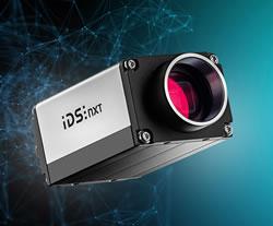
3D Vision: Ensenso B now also available as a mono version!

3D Vision: Ensenso B now also available as a mono version!

This compact 3D camera series combines a very short working distance, a large field of view and a high depth of field - perfect for bin picking applications. With its ability to capture multiple objects over a large area, it can help robots empty containers more efficiently. Now available from IDS Imaging Development Systems. In the color version of the Ensenso B, the stereo system is equipped with two RGB image sensors. This saves additional sensors and reduces installation space and hardware costs. Now, you can also choose your model to be equipped with two 5 MP mono sensors, achieving impressively high spatial precision. With enhanced sharpness and accuracy, you can tackle applications where absolute precision is essential. The great strength of the Ensenso B lies in the very precise detection of objects at close range. It offers a wide field of view and an impressively high depth of field. This means that the area in which an object is in focus is unusually large. At a distance of 30 centimetres between the camera and the object, the Z-accuracy is approx. 0.1 millimetres. The maximum working distance is 2 meters. This 3D camera series complies with protection class IP65/67 and is ideal for use in industrial environments.